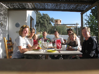
We spent a week at Camping Orgiva - a lovely small friendly campsite surrounded by the beautiful Alpujarras mountains south of the Sierra Nevada. Camping Orgiva is full of flowers,
has a few huge “centenario” olive trees,
some very friendly cats,
chickens – and a busy bar/ restaurant used by local people and people passing by.
It is about half an hour's pleasant walk into the town on a quiet wide stony dusty track away from the main road. This track is part of the “Olive Route” which features these amazing old olive trees.
On either side are fenced and padlocked orange and lemon groves
with windfalls lying on the ground 
and “Cortijos” (country houses) in various stages of repair – (some with solar panels). Dogs bark wildly as you pass.
There are flowers everywhere – particularly the heavily scented white jasmine and bright bougainvillea.
There are a couple of fields with horses.
Orgiva itself has an attractive main street but is otherwise quite run down.  It is a dusty seedy charmless town which seems to have been taken over by English people looking for an alternative way of life. It is full of English voices. English newspapers are on sale and the estate agents details are all in English as well as Spanish. It is not a place where we wanted to linger but the surrounding countryside and mountain villages are beautiful.
The villages above Orgiva are solid white blocks on the mountain side very often built along small terraces on the slopes. There is no room for them to straggle.
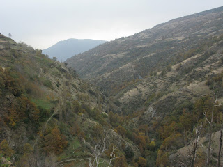
 Capiliera is one of the highest and looks typical with its white flat roofed houses piled together around the steep narrow streets. We took a bus there zigagging up the slopes surrounded by breathtaking scenery and then walked up the valley.
Going for a walk in unknown countryside is always a bit of a gamble – you are dependent on the route description you are given and waymarking and your map. In Spain the route descriptions are minimal and tend to be descriptive rather than giving landmarks. There may be some waymarking if you are lucky. The walk from Capiliera was one of the best we have done.
Although there is no signing to start with and we inevitably took a wrong turning, once we had crossed the river we joined a better marked path and because we were walking up the valley we could see our way back fairly easily.
 It was a good day for walking – not too hot!

An example of waymarking!
 We were fascinated by the landscape – the whole of this area had obviously once been a hive of productive activity with little flat roofed farmsteads dotted all over the terraced mountain slopes.
Now there are just a few olive trees and the odd patch of land is farmed but in the past there would have been crops and animals everywhere.
Each farmstead had its own threshing floor and you can see these flat circular areas made of large flat stones all over the slopes.
The ancient irrigation systems are still in evidence and some are in use.
The walk took us to La Cebadilla Hydro Electric station.
Trevelez is the highest village, furthest into the mountains and nearest the peaks.
 The bus ride – about one and a half hours on winding mountain roads - took us through amazing scenery – but sick bags were readily avaiable and used (but we just about managed without them thank goodness!)


